- Home
- Residents
- Recreation
- Streetlight Out? Report Here
- Tax rate information
- Transit
- Water Utility
- Wastewater
- Who is my councillor?
- Who maintains my road?
- Who plows my road?
- Featured Video
- Active Transportation
- Community Development
- FAQ - Frequently Asked Questions
- Garbage & Recycling
- Municipal Heritage Property
- Off-Leash Dog Park
- Online Services
- Public Safety
- The Great Cape Breton Clean Up
- Business
- City Hall
Simple and straightforward — Find the information you're looking for quickly and easily. Welcome to the CBRM website.
District 5
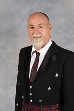
 Eldon MacDonald
320 Esplanade
Sydney, NS B1P 7B9
This email address is being protected from spambots. You need JavaScript enabled to view it.
Phone: (902) 539-0588
Cell: (902) 574-3358
The populations referenced in this description is based on the 2011 census.
This District has a population of 9,237 and an area of 8 square kilometers.
It includes:
- the North End/downtown Sydney peninsula bounded by Sydney Harbour to the mouth of the Wash Brook (a.k.a. Muggah Creek), along the Wash Brook to Brookland Street, along the center line of Brookland Street to its intersection with the railroad, southwest along the railroad to Wentworth Park and through the Park to Sydney Harbour;
- that part of the community of Sydney southwest of George Street, south of Wentworth Park, east of Sydney Harbour, and sharing a boundary with the communities of Sydney River, Prime Brook, the First Nations community of Membertou, and the community of Mira Road;
- that part of the community of Mira Road northwest of Highway 125;
- the First Nations community of Membertou; and
- the sector of Cottage Road from its intersection with Canso Drive until it becomes Edgar Street, including all streets intersecting with this sector of Cottage Road (i.e. from Canso Drive up to and including Donna Drive).
